Pages 76-79
A History of the County of Lancaster: Volume 8. Originally published by Victoria County History, London, 1914.
This free content was digitised by double rekeying. All rights reserved.
In this section
OVER WYRESDALE
Wyresdale, 1246.
Formerly part of the forest of Lancaster, this district occupies the upper part of the Wyre valley, the river being formed by the union of two main sources, called the Tarnbrook Wyre and Marshaw Wyre, and then flowing west. The northern boundary is marked by the fells stretching west from Yorkshire to Clougha Pike, the highest point, Ward's Stone, being 1,836 ft. above sea level. Between the two branches of the Wyre are minor fells, over 1,500 ft. being attained at the Yorkshire border. The southern boundary is formed by the Grizedale Fells, about 1,000 ft. in the main, but attaining 1,568 ft. at Hawthornthwaite Fell Top, on the county boundary. Numerous minor streams descend from the hills to feed the Wyre, and there are many stretches of woodland along the river and its tributaries, as well as others on the hill-sides. On the whole, however, the fells are bare. At Abbeystead is a reservoir of the Lancaster Water Works, constructed in 1855 and afterwards enlarged in order to supply compensation water to the factories then at work lower down the Wyre.
The total acreage, including about 10,000 of moorland, is 17,318, (fn. 1) subdivided thus: North of the Wyre, going east—Greenbank Vaccary, 781½ acres; Ortner Vaccary, 357; Lentworth Vaccary, 894; Abbeystead Fell, 1,635; Lee Fell, 1,335; Dunkenshaw Fell, 777½ Tarnbrook Fell, 3,336. Between the two branches—Emmets Vaccary, 546½ Marshaw Fell, 3,526½. South of the Wyre—Hayshaw Fell, in which is Swainshead, 922½ Catshaw Vaccary, 1,184; Hawthornthwaite Vaccary, 2,022½. The population numbered only 464 in 1901.
The road from Lancaster enters the township on the north-west border at a height of 940 ft. above sea level, descends south-east to Grizedale Brook, which it follows to the Wyre, crossing at Emmets to reach the northern bank of the other branch of the Wyre near Marshaw; then following the stream upwards it ascends through the wild pass known as the Trough of Bowland into Yorkshire, the boundary being crossed at a point 1,000 ft. above sea level. Another road ascends the Wyre from Ellel on the north side, crossing Damas Gill, the western boundary, at Lower Greenbank, and passing Ortner, Lentworth and Abbeystead; at this point it crosses the river and joins the other road at Emmets. There is neither railway nor canal.
The township has a parish council.
Sheep and cattle fairs are held at Marshaw in June and September.
The land is mostly in pasture, but oats are grown. The soil is clayey.
The Manchester water supply from Thirlmere passes through the west side of the township in pipes.
Forest
Nothing is known of the district before the Conquest, except that SUENESAT, or Swainshead, assessed as one plough-land, formed part of the Preston lordship of Earl Tostig. (fn. 2) Afterwards WYRESDALE seems always to have formed a principal part of the forest of Lancaster, but its bounds were not recorded in the perambulation of 1228, because from that year until 1232 it was held by Hubert de Burgh. (fn. 3) In 1297 there were twenty vaccaries, of which ten seem to have been occupied by the earl's cattle, (fn. 4) and the following are named in 1323–4: —Swainshead, Catshaw, Groghbrook, Hawthornthwaite, Hindshaw, Marshaw, Little Gilbertholme, Over Gilbertholme, Dunkenshaw (Dunnockshaw), Mickle Lea, Little Lea, Emmets, Abbeystead, Withyridding (Whiteridding), Lentworth, Calveley, Ortner, Greenbank, Harappletree, Rowtonbrook and Tarnbrook. (fn. 5) In later times, as to the office of forester and the right of hunting there were various complaints. (fn. 6)
The tenants under the duchy do not appear often. (fn. 7) Various water-mills seem to have been erected in the 16th and 17th centuries. (fn. 8) Charles Earl of Devon in 1604 purchased four vaccaries in Wyresdale from the Crown, (fn. 9) and the others were afterwards leased and sold. (fn. 10)
Lentworth passed from the Tunstall (fn. 11) to the Clayton family, (fn. 12) a pedigree being recorded by the latter in 1665, (fn. 13) and it was acquired in 1686 by Richard Shireburne of Stonyhurst. (fn. 14) In his family it descended for a century and a half. It is now owned by the Leemings of Lancaster. (fn. 15) Thomas Hathornthwaite died in 1620 holding a messuage of the king as of his manor of Bolingbroke; he had a son and heir John, about forty years of age. (fn. 16) Thomas Townley of Ortner, who died in 1739, was a benefactor to the church. (fn. 17) Another family named Cawthorne had a considerable estate which descended to Fenton. (fn. 18) This is stated to have been purchased by Robert Garnett, and to have descended to his son the late Henry Garnett of Wyreside. (fn. 19) The fourth Earl of Sefton (d. 1897) purchased the Garnett estate in the township and built a residence at Abbeystead in 1887. His daughter Lady Rose Molyneux succeeded and on her death in 1905 was followed by her brother the present Earl of Sefton.

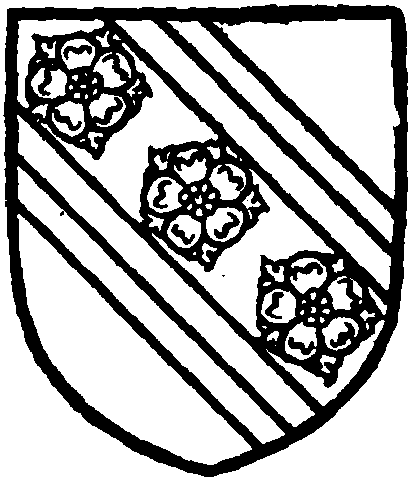
Clayton of Lentworth. Argent on a bend sable cotised gules three roses or.

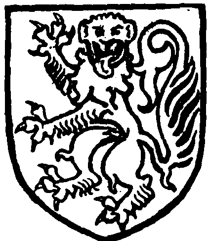
Shireburne of Stonyhurst. Argent a lion rampant gardant vert.

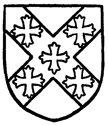
Cawthorne. Argent on a saltire sable five crosses patonce or.

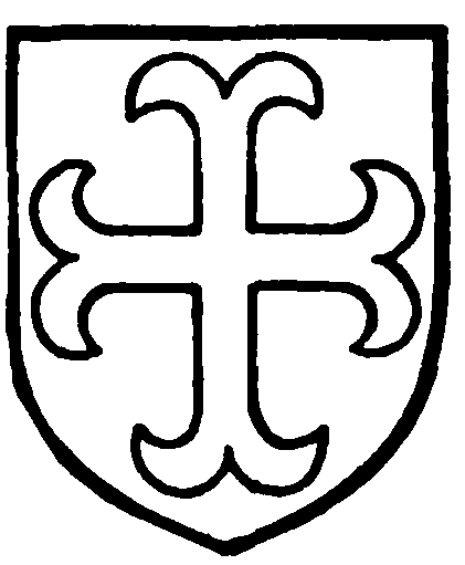
Molyneux, Earl of Sefton. Azure a cross moline or.
There is no lord of the manor. The Crown about 1895 sold the forest rights to the various landowners, so that in each estate the owner has full powers.
A report of the condition of the township in 1822 states that Marshaw, Dunkenshaw, Abbeystead and part of Tarnbrook belonged to John Fenton Cawthorne, Hawthornthwaite to Mrs. Hunter, a relative, Lee to —Hawthornthwaite, Lentworth chiefly to— Weld of Stonyhurst, Ortner to — Townley, Emmets to the Rev. — Clarkson, Catshaw to — Brown of Garstang and — Kilshaw; and Hayshaw to the Rev. — Forshaw. Mr. Cawthorne had carried out extensive improvements from 1798 onwards by inclosing, draining and applying lime: 'The land thus improved has been found capable of supporting a full-grown beast . . . per customary acre the first year. . . . The more elevated parts of the land, which are barren, rocky, and incapable of other sorts of cultivation, are planted out with mixed forest and other trees, at the distance of more than a yard from each other.' (fn. 20)
Richard Woodward in 1631 paid £10 as his fine on refusing knighthood. (fn. 21) Lawrence Parkinson of Swainshead in 1630 compounded for his recusancy by £3 a year fine, (fn. 22) and had his estate sequestered by the Parliament for 'delinquency' in the Civil War. He had succeeded his father Thomas, who had obtained a lease of the vaccary from Queen Elizabeth. He died before the end of 1652, when his widow Faith desired to compound. (fn. 23) Several 'Papists' registered estates in 1717. (fn. 24)
Church
A house of Cistercian monks existed for a few years before 1204 in Wyresdale. (fn. 25) Of the buildings no trace remains unless a few carved stones in various houses and buildings in the district formed part of them. (fn. 26) Tradition points to the site as being just below the junction of the Marshaw Wyre and the Tarnbrook Wyre on the north side of the Abbeystead reservoir. (fn. 27)
The chapel, which stands on high ground about three-quarters of a mile to the west of Abbeystead, was rebuilt in 1733, when a tower was added, but both chapel and tower appear to have been again rebuilt or restored in 1843. Before that date the building is described as having been 'bare and uninteresting,' the windows with semicircular heads and 'a square mullion down the centre of each,' and the tower was without battlements. In 1853 the interior was again restored, but it was not till 1893 that the building was properly dealt with, when a chancel was added, the old roof opened out, new windows inserted, a north vestry and south porch built, buttresses added to the walls and an embattled parapet to the tower, the whole cost of the work being defrayed by the Earl of Sefton. The pulpit, though largely modern, bears the date 1684, and there is a brass to John Barker (d. 1778) and a tablet to Thomas Townley of Ortner (d. 1739).
There is one bell, by A. Rudhall of Gloucester, 1774, inscribed with the name of Thomas Harrison, churchwarden.
The registers date from 1730 for baptisms and burials.
The earliest record of the existence of the chapel is an order by John of Gaunt Duke of Lancaster to pay £4 a year to the chaplain of Wyresdale. (fn. 28) Henry VIII also in 1509 gave £2 a year, (fn. 29) and again in 1515 ordered £2 to be paid to the chaplain from the produce of Oakenclough in Bleasdale (fn. 30) as part of the £4, which annuity continues to be paid to the present incumbent. It seems certain, therefore, that there has from about 1360 always been a chaplain nominally in charge. About 1610 he was 'Mr. Cragge, no preacher.' (fn. 31) Under the Commonwealth £30 a year was granted out of Royalist confiscations, and Thomas Denny, B.A., was 'a preaching minister' there from 1638 to 1658, and probably later. (fn. 32) The augmentation would cease on the Restoration, but the use of the chapel is witnessed by William Cawthorne's will of 1683, by which an endowment of £8 a year was given. (fn. 33) The church was served three Sundays each month in 1717. (fn. 34) It was further endowed (fn. 35) and rebuilt in 1733. The net income is now stated to be £222 a year.
The incumbents are presented by the vicar of Lancaster. The following is a list (fn. 36) :—
— Hadwen
| 1716 | Lawrence Washington |
| 1769 | Francis Lee |
| 790 | James Watson (fn. 37) |
| 1799 | James Thomas, B.A. (fn. 38) |
| 1824 | Joseph Stuart (fn. 39) |
| 1829 | Robert Watson |
| 1863 | Constantine Adolphus Lusignan, M.A. (fn. 40) (T.C.D.) |
| 1878 | Thomas Joseph Brereton, B.A. (Christ Church, Oxf.) |
| 1894 | Daniel Schofield (fn. 41) |
| 1910 | John Leonard Gamble, M.A. (Dur.) |
A free grammar school was built in 1674 by the above-named William Cawthorne. (fn. 42)
According to Bishop Gastrell there were in 1717 'many Papists and Quakers in this chapelry,' and the latter had a meeting house. (fn. 43) This is at Brooks; it was rebuilt in 1883, and is also used as a school. (fn. 44) The Wesleyan Methodists have a chapel at Emmets.


