Page 108
Survey of London: Volume 42, Kensington Square To Earl's Court. Originally published by London County Council, London, 1986.
This free content was digitised by double rekeying and sponsored by English Heritage. All rights reserved.
Citation:
In this section
The Edwardes Estate
a (above). Leonard Place, Kensington High Street, in 1923 (pp. 251,257,260-1). Demolished

Edwardes estate
Leonard Place, Kensington High Street, in 1923 (pp. 251,257,260-1). Demolished
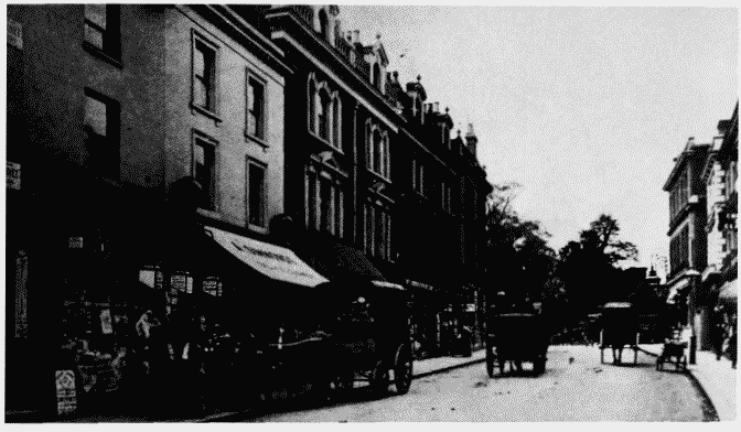
b (right). Earl's Court Road looking northwards towards Kensington High Street in c. 1905.

Edwardes estate
Earl's Court Road looking northwards towards Kensington High Street in c. 1905.
Nos. 2-14 (even) on left (p. 261). Demolished
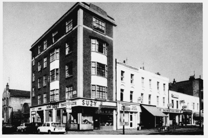
c. Nos. 40-56 (even) Earl' Court Road in 1983.

Edwardes estate
Nos. 40-56 (even) Earl' Court Road in 1983.
Nos. 40-52, Daniel Sutton, developer, 1825-30; Nos. 54-56 (Belmont Court), Fitt and Prior-Hale, architects, 1936-7; St. Barnabas's Schools on extreme left (pp. 261-2)


